Watershed Landscapes
|
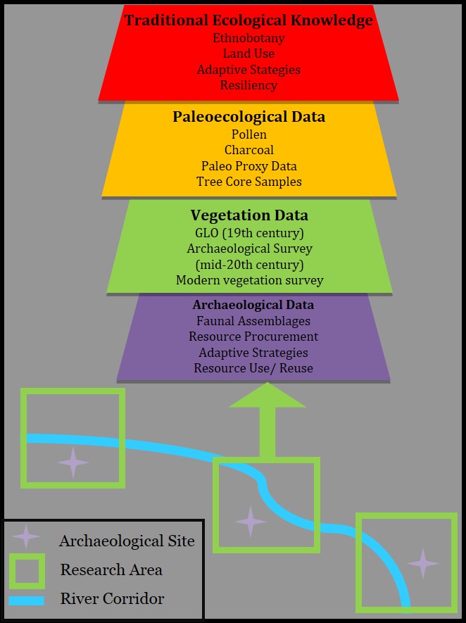
Archaeological Traces of Humans, Water Use, and Rivers in Montana: Research Objectives and MethodsThe Montana Anthropogenic Research Cooperative has been documenting and analyzing pre and post-European and Asian settlement vegetation history, paleoecological data, GLO records, and TEK acquired from a sample of rural and urban and prehistoric and historic sites associated with the Clark Fork and Yellowstone watersheds. This suite of proxy data recovered during field work and historical research is providing a backdrop and temporal scale for examining coupled natural and human ecosystems and will explore the ways in which anthropogenic alterations have influenced ecosystem structure, function, and transformations in the region. We expect that the results of this ongoing research will yield relevant information for land managers, researchers, and general public interested in the ways in which humans have influenced and adapted to climate and landscape changes in the region over time and that this will be “instructive for assessing modern societal preparedness for a changing and uncertain future” (deMenocal 2001, p. 672; see also Locke and Deardon 2005; Dalgish 2012; Hardesty 2007). |
||||
|
|
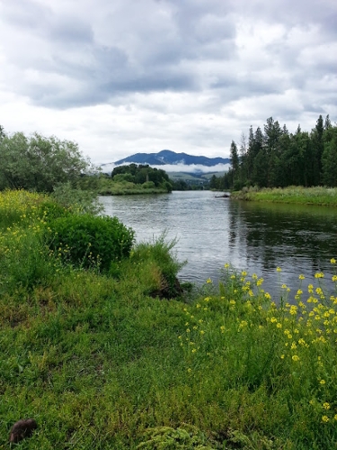
Clark Fork Watershed:In western Montana, we are carrying out urban archaeology projects dedicated to understanding the ways in which urban ecosystems (e.g., downtown Missoula and Fort Missoula) adapted to the Clark Fork and Bitterroot Rivers (cf. Grimm et al. 2008); also in this region, we are examining field sites representing rural ranching (e.g., Grant-Kohrs Ranch), remote mining (e.g., Coloma Mining District, Garnet Range), and prehistoric occupations along the rivers and in the flood plain and their inherent links to water in a semi-arid setting. |
||||
 |
Tongue River:We are also working with the Northern Cheyenne to document archaeological traces of a reservation-era village established in the early 20th century at Oévemanâhéno (Birney, Montana), which presented a colonial context of water problems linked with relatively sudden and dramatic landscape transformations. While we were working to document the ruins of reservation-era cabins at this place, known as the most traditional community on the Northern Cheyenne reservation, the elders with whom we were working quickly moved from the topic of which family lived in which cabin to their concerns with the poor quality of their drinking water, which, as they described it, was flammable. We have since learned that the wells dug for their homesteader-like log cabins during the early and mid-20th century punctured a shallow methane bed, leaving the newly formed reservation community essentially without potable drinking water. The residents of Oévemanâhéno noted that they were able to drink from the Tongue River as late as the early 1970s, and that today, they have to drive to a spring to get potable water. |
||||
|
|
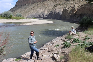
Yellowstone River:Known by native Northern Plains people as “Elk River,” the Yellowstone has long served as an important travel corridor for the region’s indigenous people. Sitting within the watershed of the river and part of a complex that is protected as both a National Landmark and a Montana State Park, Pictograph Cave has been referred to as the “Rosetta Stone” (Mulloy 1952: 3) of chronology for Montana prehistory. Thus far, our research has revealed that, through digitization of the remaining information, it is possible to virtually reposition the objects within a 3D rendition of the Pictograph Cave site, demonstrating the ways in which artifacts can be re-inserted back into their spatial locations in order to piece together what once appeared to be “lost” and/or non-interpretable provenience information. Moreover, 3-D scanning of the landscape around Pictograph Cave will help produce a 3-D model of the site’s natural setting; this, in concert with archaeological information about the ways in which the site was used intensively during the Little Ice Age, underscore the ways in which humans were more apt to use this area when conditions were more moist and cool than they were during other period over the past several millennia. |